The flight path from Queenstown to Auckland took us over the southern Alps, west of Aoraki-Mt Cook and north over Abel Tasman National Park.
A lovely day for seeing where I had been walking over the last ten days, for sightseeing and for a recce of the Abel Tasman National Park where we will be walking in ten days.
Come, fly with me.
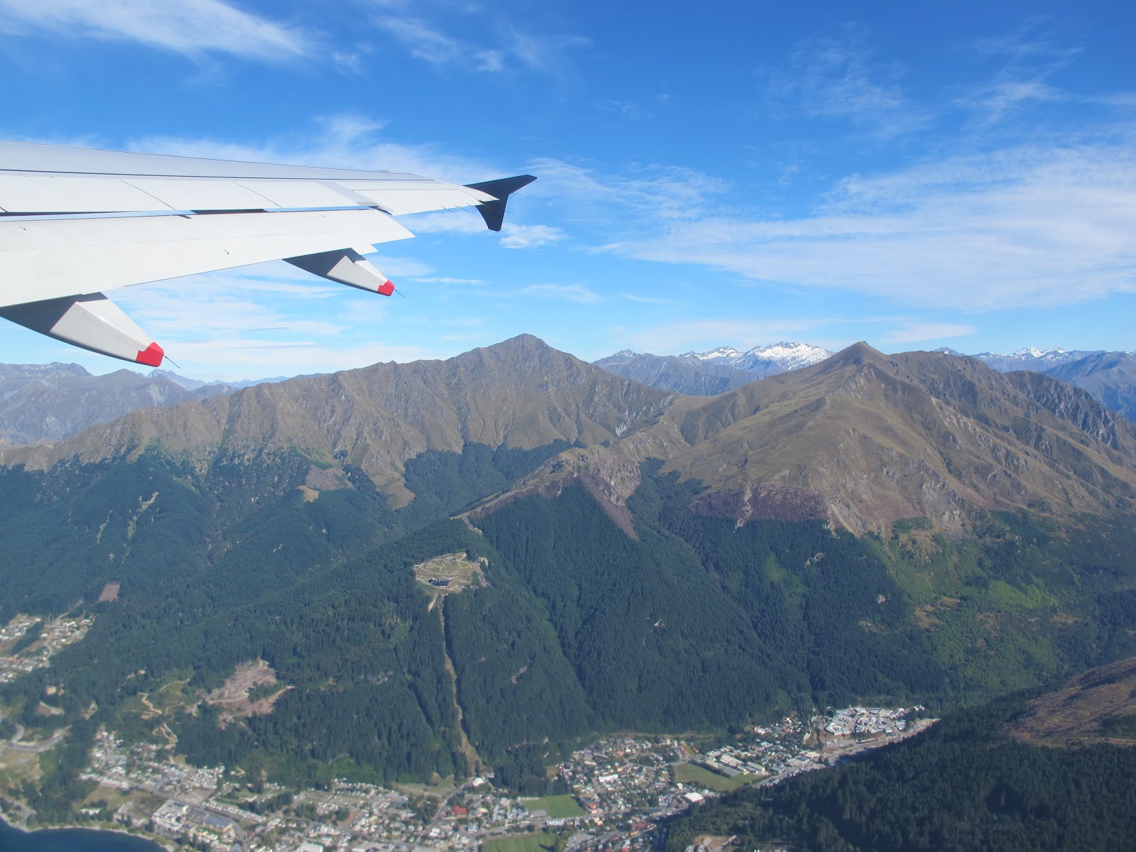
Like all tall things Ben Lomond is standing at the centre back.
At the lower left One Mile Track leads up through the forest to the cleared Skyline gondola Station area.
The trail to Ben Lomond Saddle continues through the forest, up, up, up and beyond.


That day I flew over the summit in a helicopter which landed on the Fox Glacier.

Abel Tasman national park, Tasman Bay, and Nelson city in the distance.
Far in the distance is Havelock and the sounds. I think of my childhood.
The Abel Tasman Walk will take us around these coastal bays. It looks enticing from the air.

It has been a real blessing to walk in lovely places in the Queenstown area this month.
The Abel Tasman walk looks very inviting.
I have heard so much about the beauty of this place.
I look forward to the walk and to the chance to meet people along the way.
No comments:
Post a Comment